top of page
Cable-Stayed Bridge

Surface Modeling

Ground Models You Can Build On

Building Wireframe Design
Engineer Reviewing Blueprint

We build surface models from survey data and design levels, so grading, drainage and earthworks are planned with accurate quantities.


Surface scopes we cover:

  • Existing ground from survey

  • Proposed grading and platforms

  • Cut and fill and drainage falls

Why MANSYCOM

Since 2006, MANSYCOM has delivered BIM on airports, metro systems, campuses and towers up to 2M sq ft, for clients including L&T, Tata Projects and Kalpataru.


Our process follows ISO 19650, PAS 1192, COBie and IFC, so surface modeling & drawings fits into the wider project from day one, not as a separate deliverable.
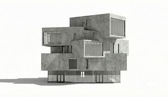
Modern Concrete Building

What You Get

Futuristic Concrete Building

Every engagement comes with clear, usable deliverables:

  • Existing ground surface

  • Proposed grading surface

  • Cut and fill volumes

  • Contour and spot level plans

  • Sections and profiles

  • Drainage fall checks

How We Work

A clear five-step workflow:

  • 1. Inputs: survey and design levels

  • 2. Model: existing and proposed surfaces

  • 3. Analyse: cut, fill and drainage

  • 4. Document: plans and sections

  • 5. Issue with quantities

Cleaning Building Windows

Tools & Standards

Team Planning Session

We work to open standards and your BIM Execution Plan:

  • Software: Autodesk Civil 3D and AutoCAD, with Navisworks for coordination

  • Standards: ISO 19650 and the project's civil design standards

  • Inputs: survey data, alignments, design drawings and utility records

  • Outputs: DWG, IFC, NWC, PDF and XLSX quantities

Where We Use It

Where this service makes the biggest difference:

  • Roads, highways and site development

  • Metro, rail and airport airside works

  • Water supply and drainage schemes

  • Campuses and industrial parks

Virtual Reality Experience

Ways to Work With Us

Team Training Session

Start small and scale up. Choose the engagement that fits your project and your team:

  • Pilot area: one area modeled

  • Project support: surface modeling across the site

  • Fixed-scope package: defined areas and outputs

Frequently Asked Questions

Answers to the questions project teams ask us most often:

  • What survey formats do you accept? Point data and CAD surveys.

  • Do you calculate earthworks? Yes, cut and fill volumes.

  • Can you check drainage falls? Yes.

  • Do you produce contour plans? Yes.

Job interview
bottom of page